How to prepare for the Kumano Kodo
Four misconceptions about training for the Kumano Kodo
Even for relatively experienced hikers (e.g. hikers who have completed the Camino Santiago), the Kumano Kodo poses particular challenges that need training for.
Myth #1 You can train in the gym
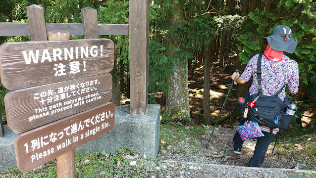
Most of the trail is either steep uphill or steep downhill. It isn't just steep slopes, it consists of stone steps, wooden steps, or rocks, which are twice as tall (at least) than modern stairs. The steepest incline on a gym treadmill is not equivalent to these steep steps; better to train walking up and down stairs two at a time.
You also need to train on different terrains, to get used to slippery moss-covered stones, slippery gravel, walking on rocks, walking on mud, etc.
Myth #2 You don't need sticks
Myth #3 You can trust the distances on the map
Because the trail is mostly uphill and downhill, with very few stretches of flat ground, the actual distances that you walk (as counted by fitness trackers) is often 1.5 x the map distance. So if the map says 15km, you should expect to walk 22km.
So you need to train distances of at least 15km regularly, and distances of 20+ km several times. Many quirks of knee strain, blistering, ankle strain etc., only pop up after walking 20+ km, so you need to get experienced with these distances.
Myth #4 You can take a bus if you're tired
This is half correct. For most of the days, you are in the forest throughout, so you cannot leave a trail halfway to find a bus stop, or even a road (unlike the Camino Santiago). You just have to hobble to your final destination.
On the other hand, if you have strained your knees or ankles, which I experienced after Day 3, you can take the bus(es) from one town to another. You do need to learn beforehand some stretching and physiotherapy exercises to help your legs recover.
You can plan to take the bus(es) at the start of certain days (Day 3 and Day 5), which will bring you to a midway point, so that you walk the Moderate route and not the Strenuous route. The Moderate route for Day 3 was enough to knock me out for Day 4, so I'm glad I didn't try the Strenuous route. For Day 5, I met a very experienced hiker who had regularly hiked mountain trails in Arizona for decades, and he described the Strenuous route as "brutal".
Maps from Oku Japan
TRAVELLING IN JAPAN HANDBOOK, WALKING DIRECTIONS AND MAPTravelling in Japan
Kumano Kodo Walking Directions pdf
Kumano Kodo Map 1
Kumano Kodo Map 2
Kumano Kodo Map 3
Your Day-by-Day Itinerary explains which sections of the Map and Walking Directions apply to your individual tour.
You will receive paper copies of the Travelling in Japan handbook, the Walking Directions and Map in Japan - you need not print them out yourself.
PREPARING FOR YOUR TRIP
Preparatory document which contains a handy packing list (page 10 - 11), "https://static-oku.diqit.io/
GPS TRACKS
If you have a GPS device, please use the following link to download GPX files for use on the trail:
GPS Tracks Kumano Kodo
OKU JAPAN BRANCH OFFICE ON THE KUMANO KODO
This is at Chikatsuyu village
https://www.okujapan.com/


Comments
Post a Comment